Nine coils of brick rising fifty-two metres over the Tigris, climbing the Malwiya, and what the Abbasid age still has to say to a traveler today.
The Spiral That Points to the Sky
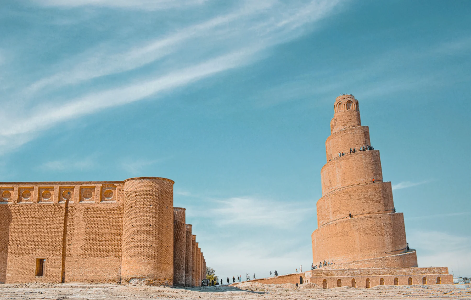
Nothing prepares you for the Malwiya. From the flat banks of the Tigris at Samarra, a spiral of brick rises fifty-two metres into the air, a ramp that coils around itself nine times, built in the ninth century for the Abbasid caliph al-Mutawakkil. Climb its seven hundred steps, and the whole of the Mesopotamian plain unfolds below: the great mosque at your feet, the river bending to the south, and Baghdad a whisper on the horizon.
The Malwiya Minaret was built in 848 CE as part of the Great Mosque of Samarra, one of the largest mosques ever constructed. The mosque's walls enclosed approximately 38,000 square metres, an area large enough to hold 40,000 worshippers. The minaret stood at the northern edge of the mosque, its spiral form visible from kilometres away across the flat Tigris plain. The name "Malwiya" means "spiral" or "coiled," and the form is unique in Islamic architecture. No other minaret in the world looks like this. The design may have been inspired by the ancient Mesopotamian ziggurats, stepped temple towers that the Abbasids knew well from the ruins that surrounded them.
Why It Matters
The Malwiya is a reminder of what the Abbasid age actually was. While Europe slept through its early-medieval winters, Samarra was the largest city on earth, and the House of Wisdom in Baghdad was translating the world's knowledge into Arabic. The Abbasid caliphs ruled an empire that stretched from Spain to Central Asia. Samarra served as their capital from 836 to 892 CE, a period of enormous cultural, scientific, and artistic achievement. The minaret is not a relic of that age. It is its exclamation mark.
Beside the minaret, the ruins of the Great Mosque of Samarra still sprawl across seventeen hectares, one of the largest mosques ever built. The outer wall, known as the Malwiya walls, still stands to a height of several metres in places. The mosque's hypostyle prayer hall, with its rows of columns and arches, gives a sense of the enormous space that once filled with worshippers. For a traveler, the visit is an hour in the presence of scale.
Samarra's Layered History
Samarra is not just an Abbasid site. The city sits on a mound that has been occupied for thousands of years. Pre-Islamic pottery and artifacts have been found beneath the Abbasid layers. The Abbasids chose the site precisely because it was already a significant settlement, and because its location on the Tigris provided both water transport and a strategic position between Baghdad and the northern frontier. Samarra was inscribed as a UNESCO World Heritage Site in 2007, recognized as the best-preserved example of a large capital city of the early Islamic period. The site includes not just the Great Mosque and minaret, but also the ruins of multiple palaces, the Al-Ukhaidir fortress to the south, and the remains of the city's water infrastructure.
On the Practical Side
- Getting there: Samarra is approximately 130 km north of Baghdad, about ninety minutes by private car on the modern road. The Mesopotamia Odyssey pairs Samarra with Ctesiphon's arch in a single day. The Ziyarat and Heritage tour includes Samarra on Day 5.
- Best time: Late afternoon, when the brick turns rose in the setting sun. The morning light is also good for the eastern face of the minaret.
- Entry fee: IQD 25,000 for foreigners, IQD 3,000 for Iraqis.
- Carry: Water, a hat. The site is large and exposed. The walk from the entrance to the minaret is approximately 1 km.
- Combine with: The Abbasid palaces (Qasr al-Ashiq, Qasr al-Bakhara), the Great Mosque ruins, and the Tigris riverbank. All within the Samarra archaeological zone. The Mesopotamia Odyssey and Ziyarat and Heritage tours include Samarra.